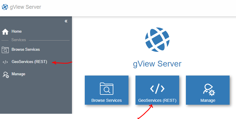
GeoServices REST Interface
GeoServices REST is an interface developed by ESRI for the ArcGIS Server. gView.Server supports this interface (MapServer and FeatureServer). Since this interface offers various tools on the web interface to test a gView.Server service, a dedicated menu item is provided for it:
GeoServices REST is a RESTful API where commands are sent to the server using HTTP GET and POST requests, typically returning a JSON document.
On the web interface, these JSON documents can be displayed. For better readability, YAML is chosen as the display standard instead of JSON.
The overarching JSON file returns the Folders and services of the first level:
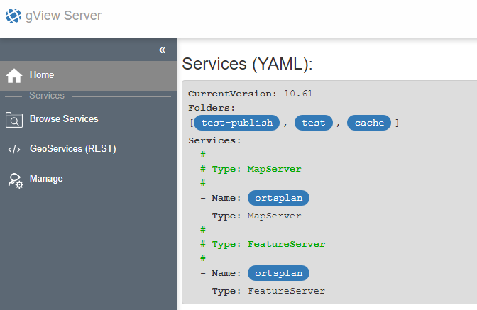
Hyperlinks are highlighted as buttons in the YAML. Additionally, some listings (Services) are
grouped according to defined attribute values (Type: MapServer, Type: FeatureServer).
Clicking on one of the hyperlinks takes you to the next view. The YAML representation
for a MapServer service looks something like this:
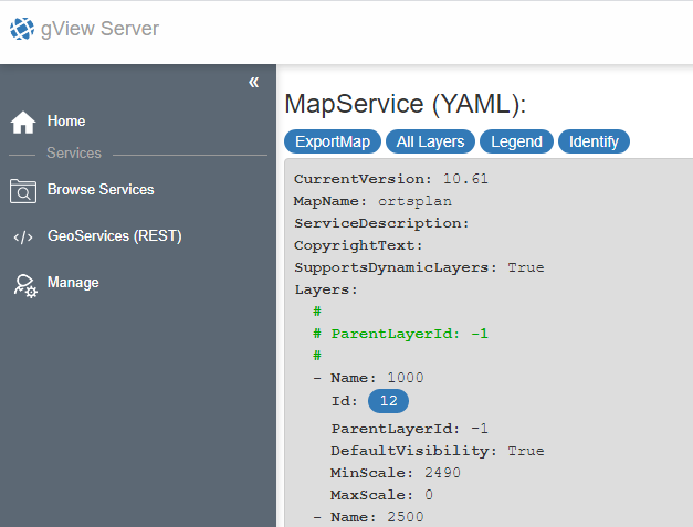
Here, further links to individual layers are available, where details about the fields are listed, for example.
Above the YAML representation, there are further link-buttons for some types.
For MapServer types, for example, ExportMap is interesting. With an ExportMap request,
a map image for a specific area can be fetched. Clicking on ExportMap
opens a form in which the desired values for the request can be entered:
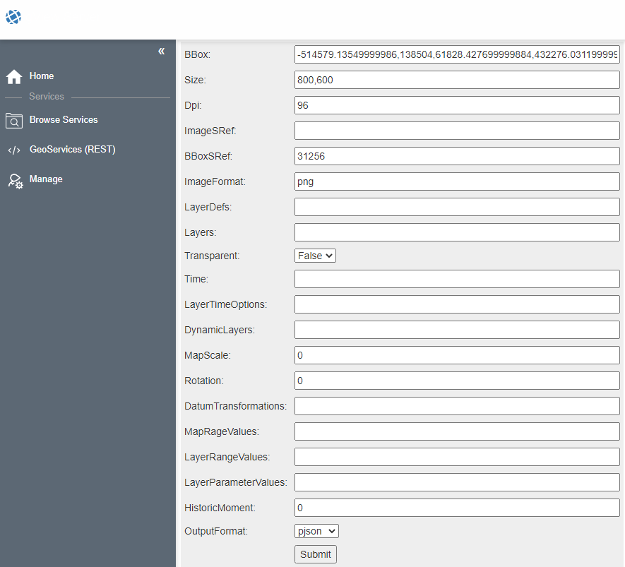
The output format can be switched from json to pjson (where p stands for Pretty,
which ensures better readability of the result). Confirming the form with Submit
yields approximately the following result:
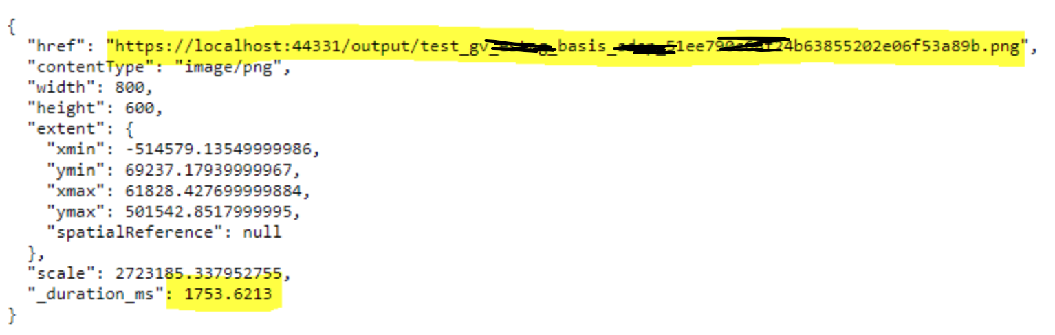
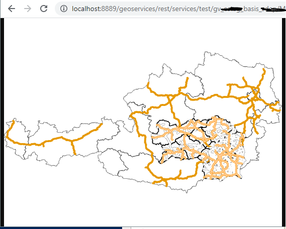
The server creates an image and stores it in the output directory. The returned URL can be copied from the JSON and pasted into the browser’s address bar. If everything has worked, a map image should be displayed.
The same result should be obtained if one steps back and specifies the value image
for OutputFormat in the form. This eliminates the intermediate step via the
JSON document:
Note
By default, the form displays the largest possible view. If no themes are visible at this scale, the result might also be an empty image. Additionally, the server returns the default layer visibility if no visibility is specified in the form.
In the same way, queries on layers can also be tested
(go to Layer YAML and click on Query).
Note
The parameters correspond to the GeoServices REST specification. This can be referenced at ESRI, for example, at https://developers.arcgis.com/rest/services-reference/enterprise/export-map.htm